
Programme of Large Topographical Surveys
Rapidly capturing high quality data
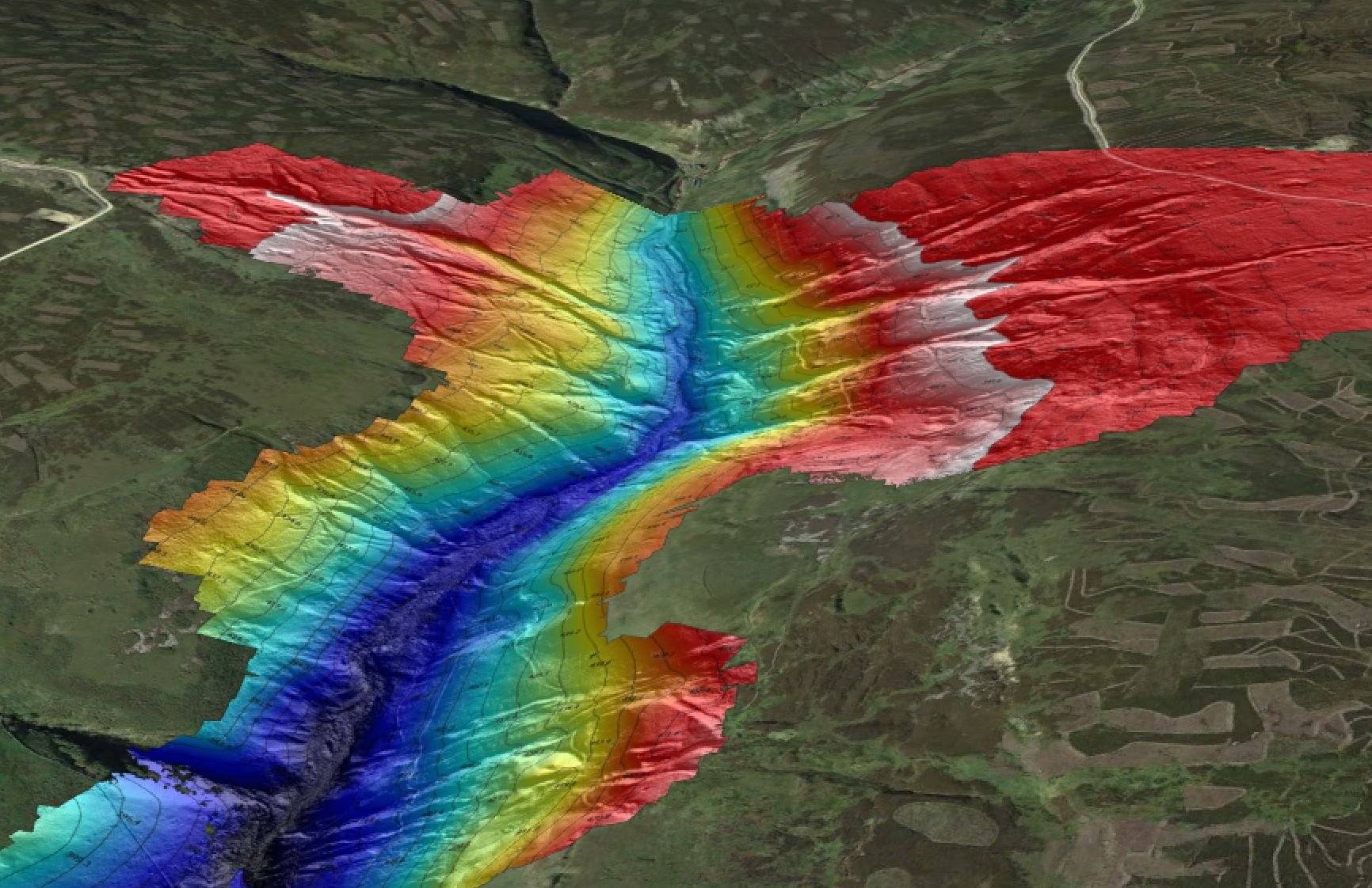
With a large scope of over 1050ha, about 10 square kilometres, this large survey required the use of a fast and reliable fixed wing drone.

Point cloud of part of a survey area
We were commissioned to complete topographical surveys of a number of former metal mines in the Yorkshire and Durham Dales.
These areas individually large but together are over 1050ha. Given the surveys were completed in winter and the sites are at several hundred metres above sea level, weather and particularly wind presented a challenge.
The survey window was quite small due to land management issues.
-

Equipment
The Wingtra One drone was a key enabler for this programme of work. With its high quality sensors, survey grade GNSS, vertical take off and relatively high operating speed it was the right drone for this work.
-

Ground Control and Checkpoints
Nearly 100 ground control and check points were established across all the sites using survey grade GNSS. Given the location and type of ground this involved a lot of walking.
-

Processing Capability
We used the industry leading PIX4D Matic for photogrammetry processing and Beamworx to produce charts. Both these applications require high end computing platforms to process large surveys quickly and efficiently.